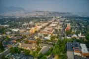
Resort village, neighbourhood improvement area, gentrification — at one time or another, Toronto’s Parkdale has been home to it all. Though the west-end community, which became a municipality of its own in 1879 and was amalgamated into the City a decade later, has mostly been untouched by the condo development unfolding in other corners of the city, that doesn’t mean it hasn’t undergone drastic, noticeable change.
Once marred by drug busts and violent crime, the neighbourhood bounded by railway tracks to the north, Dufferin Street to the east, Roncesvalles to the west, and Lake Ontario to the south, has drawn galleries and independent shops in more recent years, joining the existing Little Tibet and grittier remnants that linger.
To give a sense of how much Parkdale and nearby areas have changed over the last 100 years, we’ve compared historic photos of the area with recent shots by BuzzBuzzHome’s James Bombales as part of our continuing series of then-and-now photo tours, which also spans Liberty Village and Bloordale.